10.14.26
The part of the sky we’ve always flown past. Until now.
Mike Moses, Spaceline President, Virgin Galactic
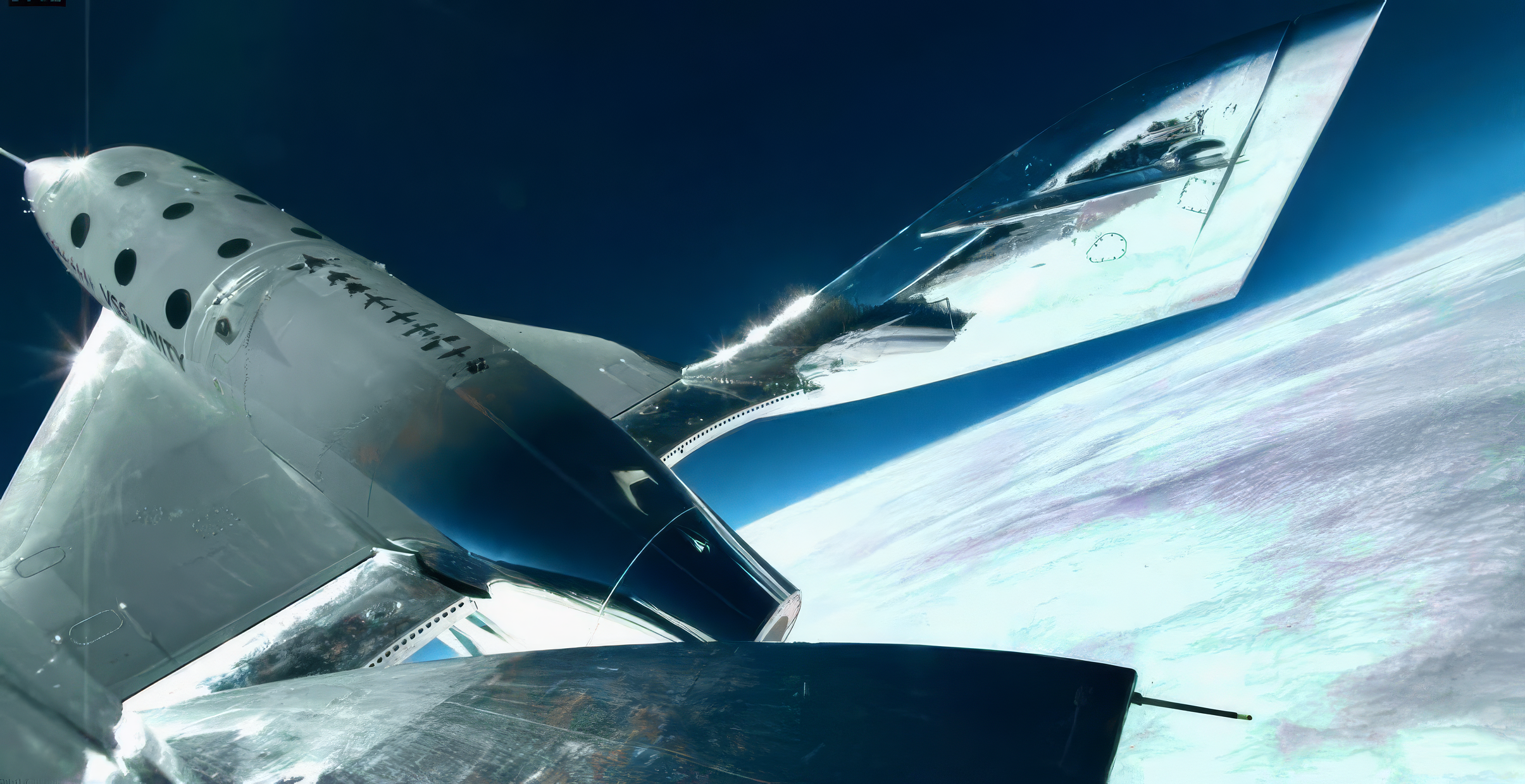
Roughly 30 to 70 miles above our heads sits a region of the atmosphere that scientists know remarkably little about. It’s not for lack of interest, but because nothing has been able to get there routinely or stay long enough to exhaustively study it. The highest-flying research balloons touch its lower edge. Sounding rockets reach it, but only briefly and infrequently. Most satellites orbit above it because, any lower, and the atmosphere would drag them down.
This layer of the atmosphere could shape everything from climate modeling to orbital tracking, yet it remains one of the least-measured regions of our planet. We believe our spaceships can change that, by providing frequent, repeatable access to a part of the sky that has gone largely unresearched simply because no one could reach it on a regular basis.
H. Todd Smith, a Principal Staff Space Physicist at the Johns Hopkins Applied Physics Laboratory who has spent two decades on NASA interplanetary missions, describes the scale of the problem like this: “We have more direct observations of a key chemical component of the atmosphere of Titan [negative ions], a moon of Saturn, than we do of this region of our own planet, somewhere between 80 and 90 kilometers up. It is dramatically understudied, and yet it may be one of the most significant regions of our atmosphere.”
That’s a problem of access, and every established option involves a trade-off. Balloons drift where the wind takes them, and their payloads land wherever the wind leaves them. Sounding rockets return real-time data, but flights are infrequent and costly, and payload recovery isn’t guaranteed. Rockets bound for orbit punch through it in moments, on their way somewhere else. None of these platforms were built for what atmospheric research actually requires: repeated measurements, taken under controlled conditions, with the instrument coming home intact.
Frequency is fundamental to understanding
A single measurement tells you what happened on one day, a snapshot. Hundreds of measurements, taken on a regular cadence, give you a dataset which can tell you how a system actually behaves.
Part of what makes this region so worth measuring is how much we still don’t know about it. “We are still in the frontier phase of this work; in many ways we don’t yet know what we don’t know,” Smith says. “As these vehicles begin flying routinely through this region, I expect it to drive a fundamental shift in how we understand not just Earth’s atmosphere, but atmospheres in general.”
Our spaceships are built to fly into the mesosphere and lower thermosphere again and again. Each ship is designed to fly twice a week, and with our initial fleet of two spaceships we’re planning for around 125 flights a year, scaling to many more than that as the fleet grows. That’s a research cadence this region has never had. Sensors collect data across the full flight profile, which includes ascent, the microgravity portion, and descent. As the ship coasts toward apogee, it slows dramatically, giving instruments several minutes in the region before re-entry. Over time, that cadence builds something that hasn’t existed before: a growing record of conditions in this part of the atmosphere. We believe a platform that can fly slowly and repeatedly through this zone are exactly what this field has been missing.
A better ride for the instrument
On our vehicles, we have the capability to install external sensors safely and securely. They can be fitted into an engineered space and returned safely after every flight, and because our spaceships are designed to carry people, the ride is comparatively gentle. That matters for instruments that are complex, expensive, or in some cases designed for a laboratory bench and not a high-G sounding rocket.
Guaranteed return of the payload changes the economics of this research. Instruments can fly, come home, be checked and recalibrated, and fly again on the next mission.
A platform, not just a vehicle
Today’s agreement with the Air Force Research Laboratory at Kirtland Air Force Base is a good example of why this matters. Under the 24-month Cooperative Research and Development Agreement, AFRL researchers and Virgin Galactic plan to evaluate integrating sensor systems into the spaceship to collect space weather data during flight, targeting the mesosphere and lower thermosphere directly.
Last year we signed a similar agreement with Lawrence Livermore National Laboratory, which focused on a different sensor and different environment aboard our launch vehicle. By being based on our launch vehicle, these imaging sensor systems would operate at the troposphere-stratosphere boundary around 50,000 feet, where more than 88% of atmospheric molecules and 99% of active weather reside.
A vehicle that flies on a predictable schedule gives researchers something no single mission can. As Dr. Shaun Ard of AFRL noted, understanding space weather in this region “depends on consistent, high-quality observational data, which has remained limited at scale.” Smith puts it more bluntly: “For years this layer was so hard to reach that its presence was often ignored.”
Because better data from this region underpins everything from climate modeling to orbital tracking, and even the fundamental question of why Earth has a protective atmosphere and why other planets such as Mars do not. Without it, we are seemingly modeling our atmosphere with critical gaps. I’ve spent three decades in flight operations, at NASA and at Virgin Galactic, and the hardest part has never been flying once. It’s building a system that flies again next week, and the week after that. That’s the work we’re doing now, and as flights become routine, we hope to see the study of this region grow into a scientific discipline in its own right.